Monthly Archives: August 2014

Beach Party!!

ESS at Kouchibouguac beach

Our tired group woke this morning to shaking tents at 7:30 a.m. (by Bobby and Dr. Erikson). Breakfast seemed to have a flavour of DEET mixed in because of all the bug spray we put on to deter the swarms of mosquitoes. After that we had a lecture on atmospheric circulation patterns.

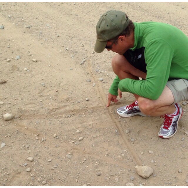
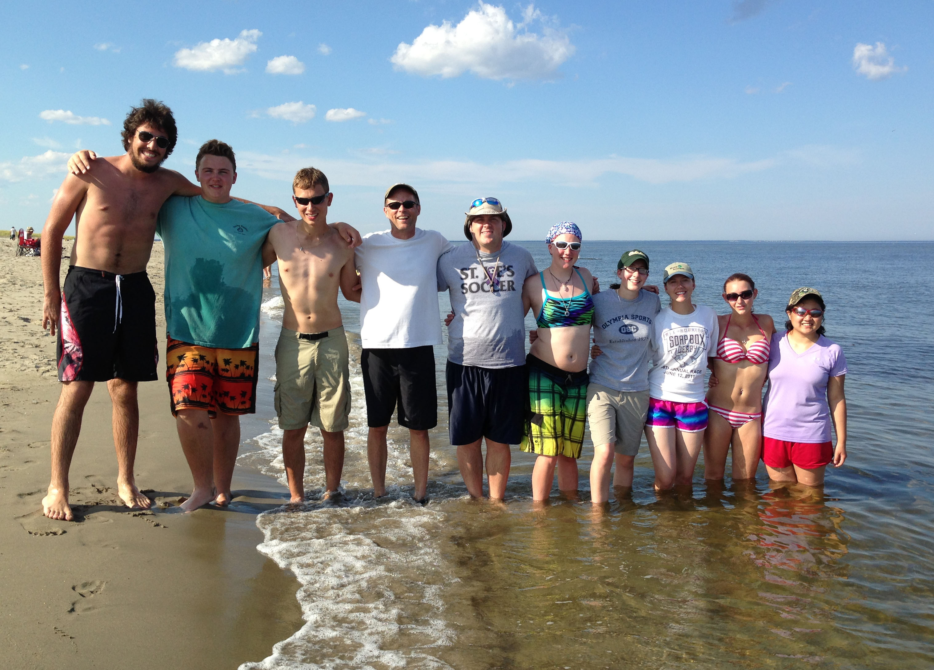
Then we went to Kelly’s Beach (here in Kouchibouguac National Park, New Brunswick) just a 2 minute drive away. Except it wasn’t all play and instead much our time was spent measuring the beach profile. We measured the slope of the beach from the crest of the beach berm down about 40 m to the water, and then underwater for another 90 m all the way out to a shallow sand bar. For each part of the profile, we determined variations in sand sizes using a stack of sieves. When we had some down time it was nice to cool off in the ocean (to our surprise a bit warmer than at home) considering how hot the sun was. Unfortuanetly some of us got a bit burnt from the sun’s rays. We had some great finds out at the sand bar, including crabs, hermit crabs, snails (some small and some quite large) and most interesting Andrew caught with his hands an unsuspecting flounder (a strange looking flat fish with both eyes on one side of their head).

Bobby delivered our usual lunch of cold cut sandwiches to the beach, this time treated with oreos. After completing our profile for the afternoon we went back and had a dinner of chili and pasta with cornbread and salad. Dessert was amazing (strawberriy short cake).

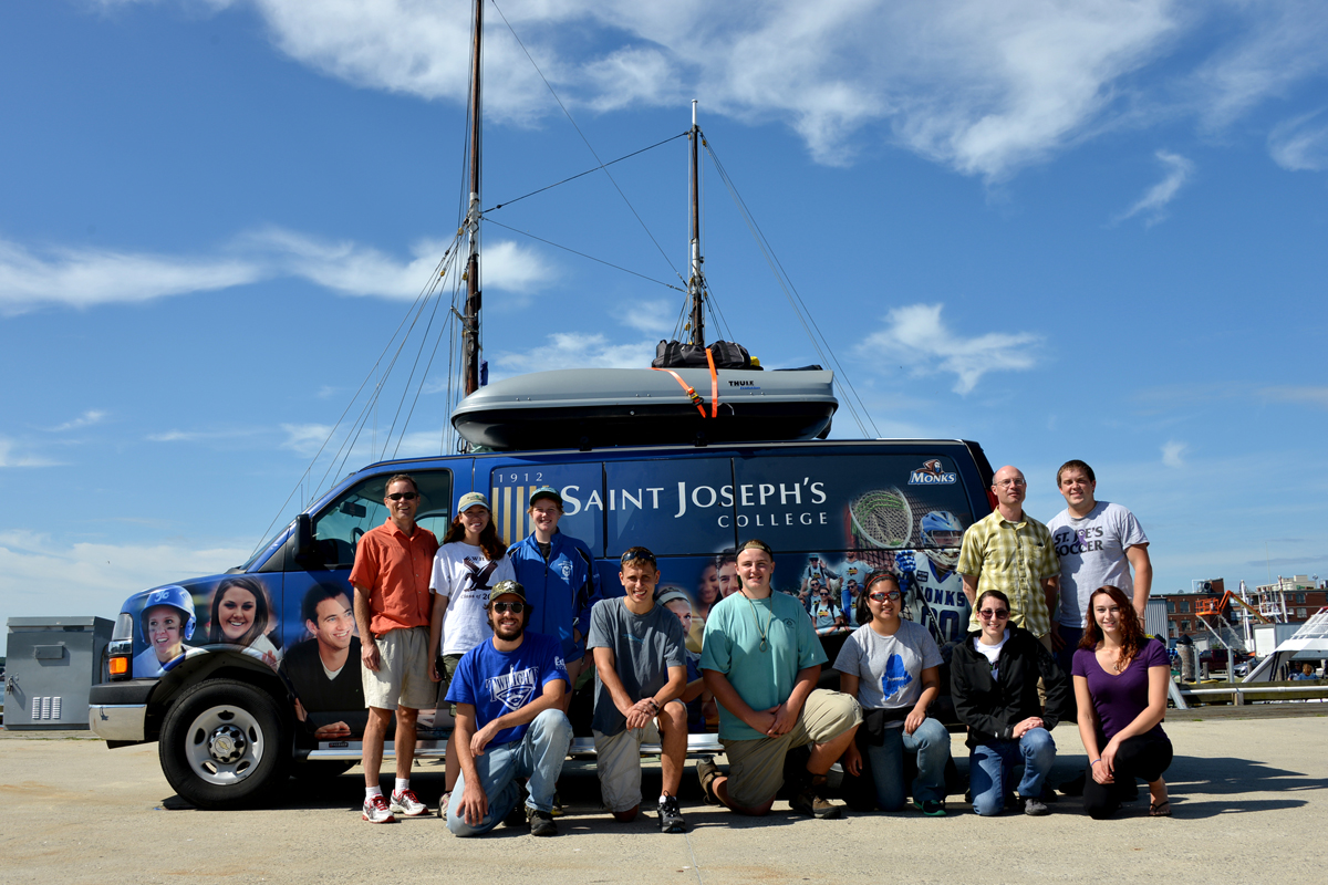
Tonight is on our third night of actually camping (10th night total). We’re making it along really well and excited for the many days ahead.

– Matthew Pfannenstiel

Night Skies

We spent the past few days at Kouchibouguac National Park in New Brunswick, looking out on the relatively warm waters of Northumberland Strait (toward Prince Edward Island).  I’ll let students write about our days.  Here, I’ll just comment on our nights.

Stars.  Wow.  I think this part of New Brunswick participates in a dark-night initiative in which they intentionally minimize the amount of nighttime illumination.  That means fewer bright signs, downward-directed lighting, and dimmer lighting in general.  The effects are spectacular.

For several clear nights in a row, we could see not only the big, bright stars, but even the myriad little ones.  I saw constellations that I haven’t seen in years.  Milky Way?  Oh yeah, bright from horizon to horizon.

Satellites? Oh yeah, 2, 3, and sometimes even 4 satellites could be seen simultaneously, some moving in parallel paths, some in criss-crossing paths.  Some brighter and moving fast, others dimmer (farther away) and moving slowly.

And then of course, there were the shooting stars.  August is a good month for shooting stars in general, and we weren’t disappointed.  On two occasions I saw a flash, rather than a streak, which probably was a shooting star coming almost directly toward us, rather than across the sky; sorry, no photos!

The price for the beautiful night sky was collected by the mosquitoes.  But they were really only bad from 2 hours before sunrise and sunset to 2 hours after sunset and sunset (and sometimes in the middle of the day if the wind wasn’t blowing).  The campfires certainly helped, and the skeeters pretty much disappeared by the time we got to dessert and games of Liar’s Dice.

The academic content is getting a bit thicker about now, with a recent labor-intensive beach transect and a lab report on bedrock fracture patterns due tomorrow.  Fortunately, frisbee on the beach and good food soften the discomfort.  Hard to believe, but they have a mid-term exam (for Climate Change and Glacial Geology) on Friday.

– Johan Erikson

First Day in Canada

Saturday morning, we got up and our objective was to clean out most of our food supplies, because we could not carry most things across the border. We left our “home” at 7:40 and when we had to cross the border into Canada, thankfully they did not have to search the van. However, we did have to wait around for 40 minutes getting our passports checked. We entered Canada at 11 and because of the hour ahead time difference, dinner was at a late hour that night. We had lunch at Saint John, in New Brunswick. We all ate a variety of foods from the public market and a few of us even ate in the park. As we were walking around, we came across people from all over the world that were carving stones and making sculptures out of them. If you ask me, I thought it was pretty neat! Nevertheless, we got back in the van and drove for another 3 hours till we reached out destination in the campground of Kouchibouguac. On our adventures driving there, we almost squashed a Prius, came very close… Once we got to the campground, we had to put up tents, and that was a struggle for those of us who were new to camping. So, yeah that was our day of fun.

passport

-Courtney Couture

Dropstones and Blueberries

Today started off with a delicious breakfast of waffles, with fresh (store bought) blueberries, strawberries, and bananas.  We hit the road in our SJC van around 8:30 am.  We were headed to Cherryfield, Maine, which deceivingly is actually the “Wild Blueberry Capital of the World”. On our way there, we passed the Wyman’s of Maine factory.  Anyone who buys frozen blueberries in Maine knows that Wyman’s is the brand you buy. As we passed the factory, we smelled the scent of blueberries in the air.  We also drove past many of Wyman’s blueberry fields, one of which was getting watered, spraying a little bit of water onto our windshield.  There, we stopped to look at the land, which was actually a flat delta and the highest elevation in that area.  Normally, deltas are not the highest spot in an area, so this was an interesting location.  We looked at the type of glacial sediments on top of the bedrock, which seemed to be mostly sand and gravel.  We also looked at really colorful geology surficial and bedrock maps, learning about ribbed moraines and how they were formed.

Then, we moved onto another location in the area and Dr. Erikson used “conveniently placed” road dirt to teach us about triangulation and how to determine position using it.  He told us that before GPSs were invented, scientists based property lines off of data they got from measuring angles and distance between certain plaques on the ground.

IMG_9355

After that, we drove to a field to look at erratics, which are rocks that are not where they are supposed to be.  There was an entire field of them, all of various sizes, but one literally stood out to all of us.

This large erratic was a dropstone, meaning that it once was a part of a glacier, but floated away from the glacier, inside of an iceberg.  As the iceberg melted, the rock fell out and dropped on the submerged delta. This specific rock was about 5 m high and 5 m across. A bunch of people wanted to climb it, and looking at the challenging climb it took them to get up to the top, it was not an easy one to say the least.  All around the boulder were fields and fields of blueberries.  We may have been trespassing, but we are not sure of that. Some of us picked a few of the lowbush blueberries and some of us climbed up on top of the rock.  Some of us did both.  Either way, it was a fun day for all of us.

IMG_9285              IMG_9297

-Nhu Vo


Bog Brook Cove and Quoddy Head

The gang at the iconic light house at Quoddy Head State Park. The most eastern point in the United States.


Just doing a little rock climbing. From the left: Andrew M., Nhu V., Ayla R., Matt P., and Alana D.

On Wednesday afternoon, after being literally distracted by “Wild Blueberry Land“, we arrived at the trail head for our 2-3 mile stroll along the Norse Pond Trail. We arrived at one of my favorite classrooms of the day (of the trip for that matter) – Bog Brook Cove. The trail led out to a beautiful cobble stone beach with lapping waves. Prior to class, the group broke off in various directions to explore. Some of us went swimming while others searched for rocks with intricate designs and patterns. It could not have been a nicer day for the beach: the sun was shining, the breeze was blowing, and our minds were wandering. When Dr. Erikson reeled us back in, we sat down for a lesson. We learned about nonconformities in rocks, remnants of glaciers, and how sea level affects the topography of an area. Things such as drop stones, marine clay, the size and location of cobbles, and different layers of sediment. We later finished the day with an exhilarating trip to Quoddy Head State Park – the eastern-most point in the United States. After a few group photos, the majority of the group took off over the fence and scaled the cliffs. Fun fact: In 5 days we’ve eaten 12 loaves of bread, 7 lbs cheese, 10 lbs of deli meats, and 55 ounces of pretzels.

-Alana Dougherty

The Bubbles

Yesterday afternoon we went to the strangely yet appropriately named ‘South Bubble.’ The South Bubble is a several hundred foot tall mountain in Acadia National Park just outside of Bar Harbor. It is called a bubble due to its bubble-like shape as it emerges from the ground, and is just south of the slightly taller North Bubble. We were dropped off in the parking lot at the base of the land mass and began the short hike up. As we neared the top, we stopped to practice creating topographical maps at a clearing to create our rendition of the surrounding landscape. We continued to and past the summit towards the southern side to overlook Jordan Pond as well as the distant ocean. From that vantage point it was clear to see where the glaciers came through several thousand years ago and shaped the landscape today. After hiking down (in a sudden rain storm) we made a quick stop at the coast before heading into Bar Harbor for dinner.

-Andrew


photo

The Clown Car

On Saturday morning we arrived at the Maine State Pier to finally begin the trip that we have been planning for the past several months (well probably last minute, like this week).  As more students arrived, as did the amount of bags. With our two Thule boxes, one cargo rack, and a very minute amount of extra van space, we began to speculate if we would EVER fit in at all! After Mother Bobby cooked up some breakfast sandwiches on our camping stove on the pavement, so began the stuffing bonanza.

SJC_ESS

We watched as our parents and professors struggled to fit more than three bags into each Thule. It was clear that we were all bringing just about a year’s worth of supplies. Parents began to place “bets” of how far we would make it before losing a wheel. Even some saying, “well, if you guys flip the van, at least we know you’re not moving too far,” poking fun at the tightly packed van.

SJC_ESS_053

Regardless of comfort, all faculty and students have made it to The Schoodic Education & Research Center safe and sound. Now we are all much closer figuratively and literally. Now let’s start off this amazing adventure!

– Erin Wright-Little

Prepare to Launch.

SJC 3pms logoStart time and place.  We will meet between 8:00 and 8:30 on Saturday morning, Aug. 16.  Our gathering spot is the Maine State Pier in Portland.  This is the pier at the Casco Bay Ferry terminal on Commercial St. in Portland, and it’s where the schooner Bagheera is tied up.  We’ll be on Bagheera for two weeks at the beginning of October, so this is your chance to see her before we actually get on board.

We’ll have light breakfast food available (including coffee and juices), so if you find that getting here is a bit hectic, you will have a chance to fuel up here.  Parents/guardians/etc. are certainly welcome to come (and there will be sufficient food for them).

Parking is challenging near the Maine State Pier, so I recommend that you pull in, drop off your stuff where you see me and our group, then go park the car (if you have parents/guardians/etc. wishing to see the group before departure).

If you have a spare bag with extra clothes, etc., that you want to NOT take for the first month or so of the ESS, then this is the place where you’ll drop it off.

This is also the spot where you’ll return to at the end of the ESS (actually, it will end over on Peaks Island, but this is a logical pick-up spot) on Saturday, October 18.