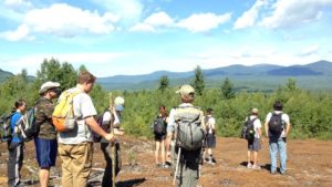
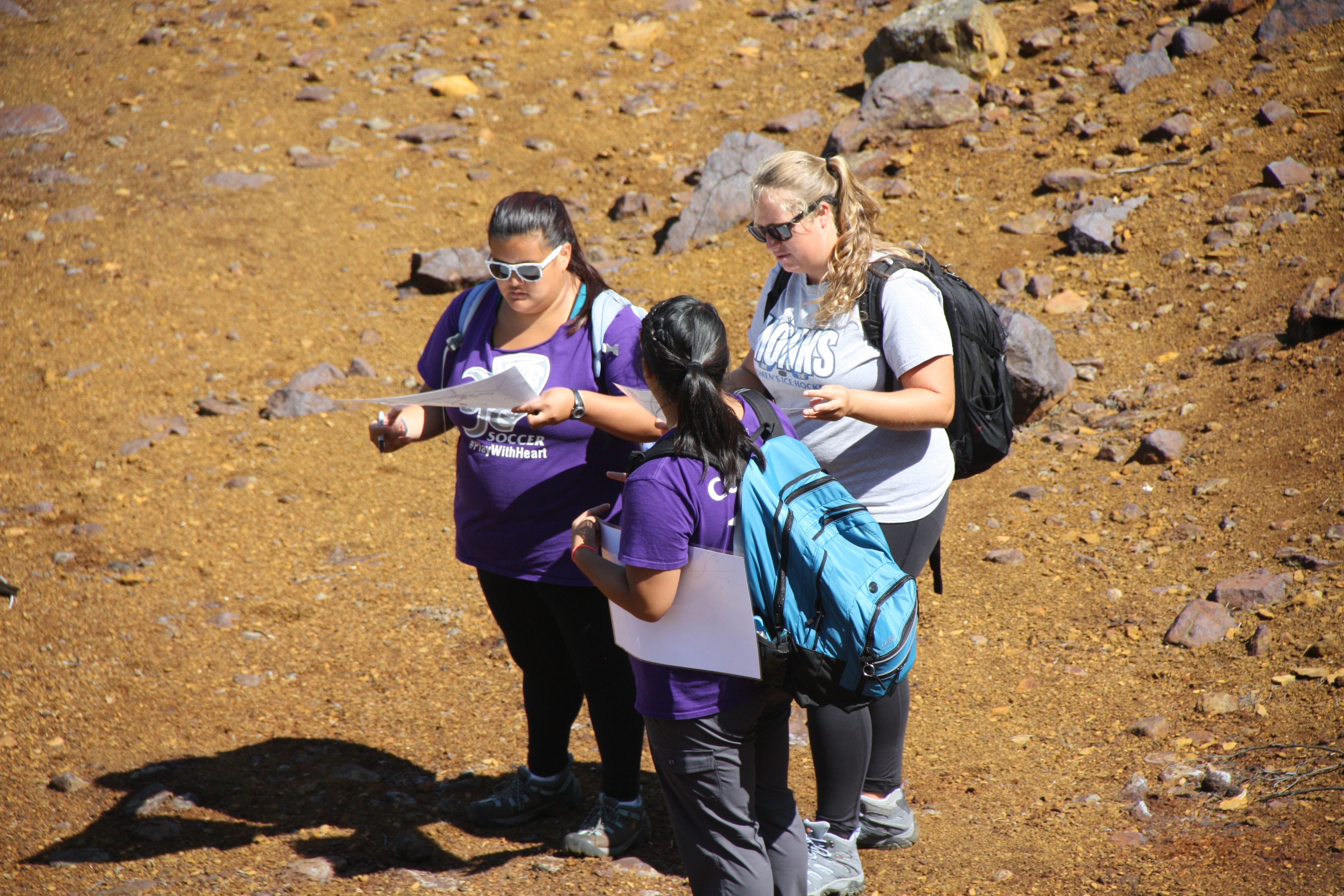
People have heard of experiential education. This is the educational practice in which learning is enhanced and made meaningful by engaging with and working with the subject matter, as opposed to just reading or hearing about a topic. The Environmental Science Semester takes experiential education to a new level and requires a different name. We’re calling it immersion education–students are immersed off campus and in the field only in the study of environmental and marine science topics for ten weeks.
Students will live and breathe glacial geology, climate science, marine ecology, and oceanography day in and day out. It will seep into their pores.
The immersion educational experience has led previous ESS participants to report that they not only remember and understand so much more of what they’ve learned on the ESS compared to normal classes, but they can also remember when and where they learned most of it.
When I return in October, I won’t return with the same students I left with. They won’t be the same people – they will be transformed into confident students and practicing scientists who have shared an experience that bonds them to each other and to our team of faculty for a lifetime.
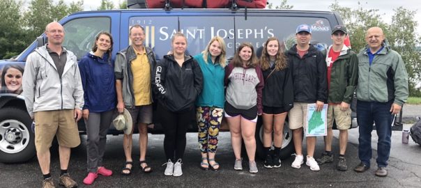
We’re off on another ESS! And I couldn’t be happier!
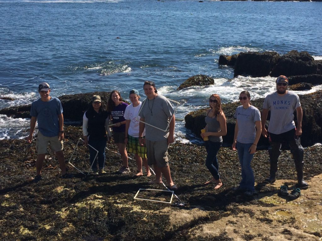
It was a gloomy, rainy morning as we boarded the Bagheera on Peaks Island and set sail to Jewell Island in Casco Bay. We stopped at various places near islands to collect data from a CTD sonde, which measures temperature, salinity, pH, dissolved oxygen, turbidity and chlorophyll at various depths. We also took a core sample of the top 20 cm of the seafloor sediment by dropping a coring device attached to a cable off of the foreboom. Then we reeled it in and analyzed the muddy sediment. Once on Jewell Island we lowered our dry bags and food into Dr. Erikson’s little boat that we are towing for the entire voyage. Getting all of our gear to shore took several trips. We set up tents before it got dark and started getting dinner ready. The rain let up for a little bit until dinner time, when it picked up again, but fortunately we had a big group tent that could keep all of us out of the rain.
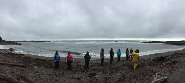
The following day we had lecture at the island’s Punchbowl. Here we learned about wave structures and how the two sides of the Punchbowl were affected differently by the same incoming wave sets. One side of the Punchbowl had rough waves and the other side was calm with hardly any waves flowing in, due to the friction generated by the shallowness of the bottom. We saw a dead seal that was missing its tail fins and you could see the jaw of the seal. It was so interesting, yet saddening at the sight of the poor mammal. We moved to the calmer side of the Punchbowl, where we learned that area was a big nursery during the summer months for organisms because predators could not get to them due to the water being so warm and shallow.
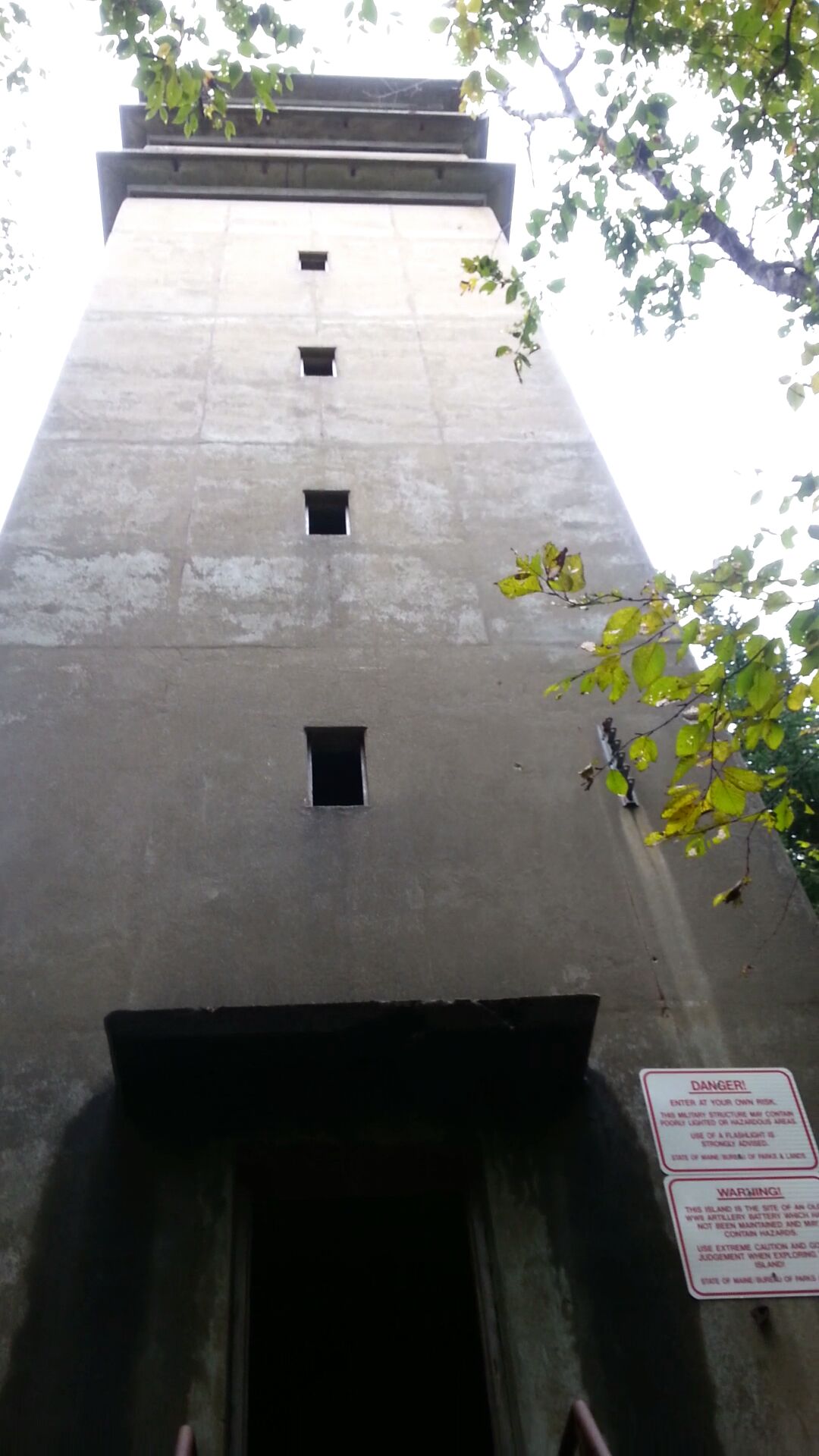
After lunch we went on a hike through the island. We saw two towers used for triangulation during World War II. One tower was about 5-6 stories high. From the top we saw above the trees the entire island, Portland, Halfway Rock and many miles out to sea. We reached a part of the island that had the WWII tunnels where ammunition and communication equipment were stored. We walked through the tunnels with many side rooms, large and small. On the far side of the tunnels, we reached what was left of large gun turrets. The structures were so fascinating and a part of history I didn’t know even existed from World War II.
It’s time for me to write a post, since the students are immersed in writing a paper and preparing for a final in Climate Change and Glacial Geology. Yes, it is very early September and they are faced with a paper and a final. We’ve been on the road for over 3.5 weeks, which puts us 1/3rd of the way through the ESS. Quite soon, we will finish here (Crawford Notch in the White Mountains of New Hampshire) and head to Popham Beach, where Prof. Greg Teegarden will start leading the students though Marine Ecology. But before we wrap up here, let me point out some highlights.
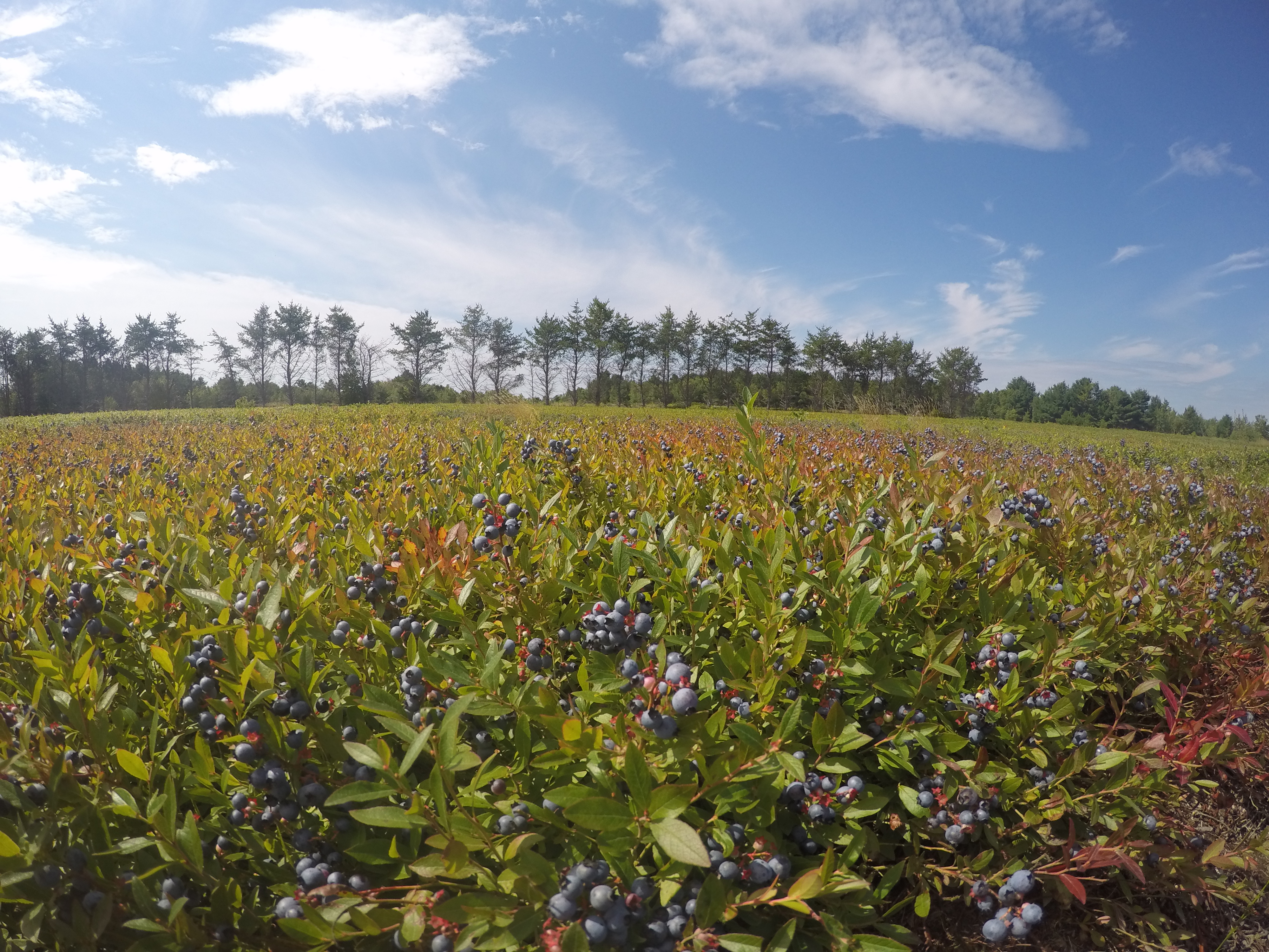
Blueberry fields near Cherryfield, Maine grow on deltas that accumulated in a frigid sea when relative sea level was briefly 60 m higher than today about 15,000 years ago as glaciers receded. Joe O’Reilly joined me and Andrew atop an enormous boulder carried to this site by icebergs.
DCIM100GOPROGOPR0246.
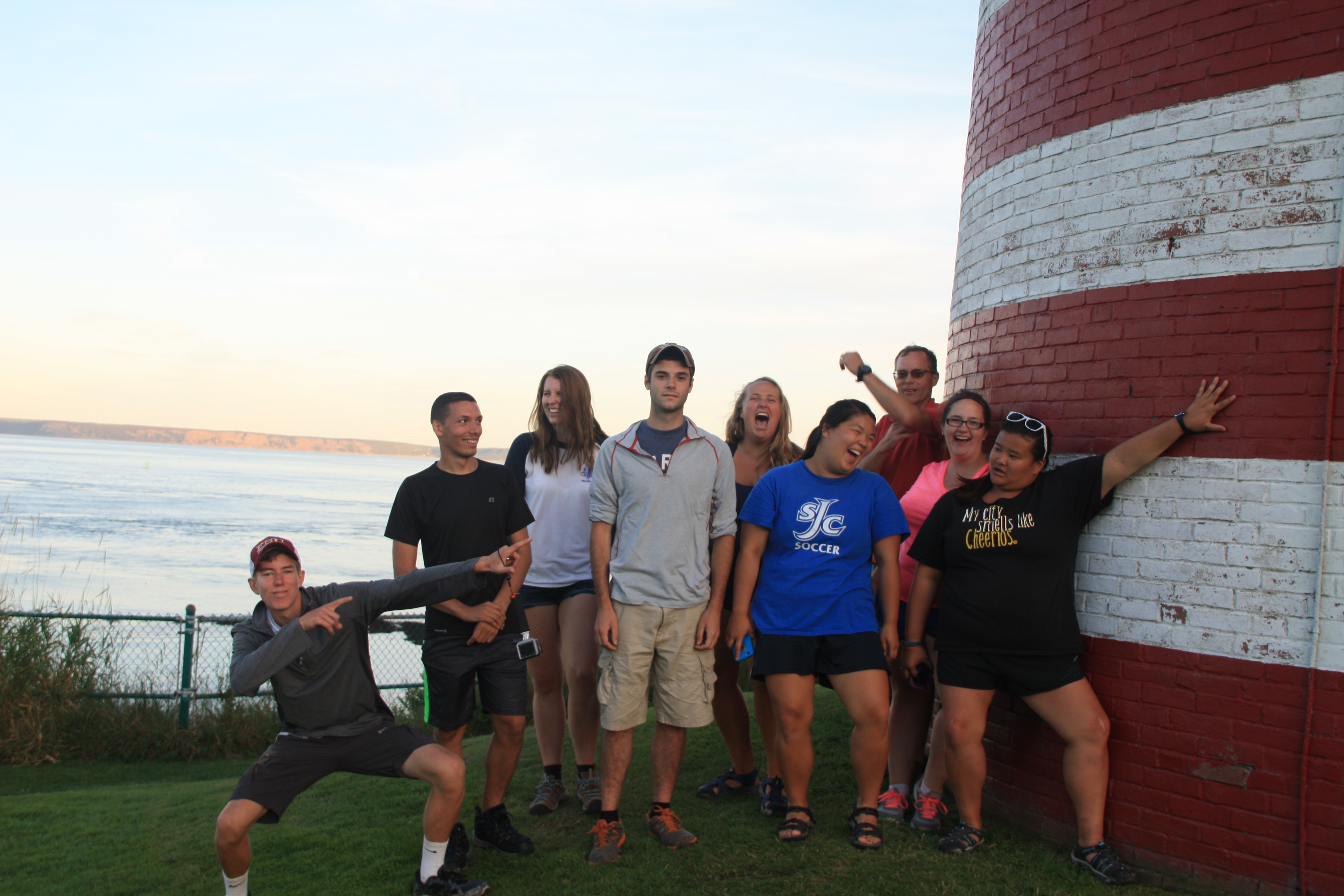
West Quoddy Head lighthouse is the easternmost point in the US. Everyone seemed amused thinking that there were 320 million Americans to the west of us, and zero to the east!
It’s hard to appreciate just how fast the tide can come in. At Fundy National Park in New Brunswick, we studied the 1 km long Point Wolfe inlet. We were in the flat, middle part of the section when the tide caught up with us. The water was creeping over the land nearly at walking speed. Stand still to take a measurement, and the water would rise above our ankles. Crossing the “little” intertidal stream on the incoming tide got Emma Mills ’19 in water up to her chest.
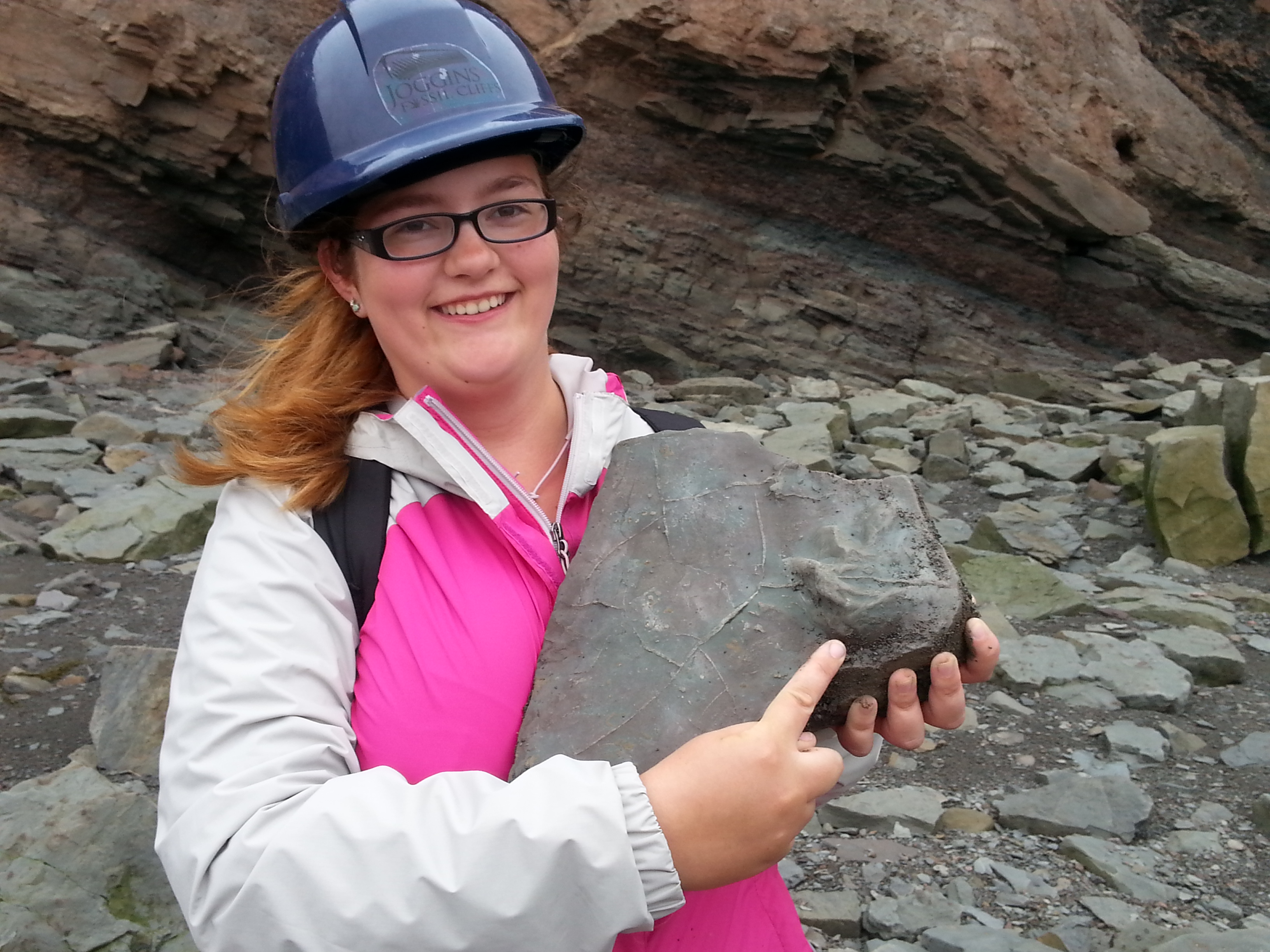
At Joggins Fossil Cliffs in Nova Scotia (a UNESCO World Heritage Site), we walked along beach cliffs (at low tide!) for about 5 km and through about 5 million years of ancient, really ancient history. These rocks have yielded the oldest reptile fossil in the world at about 310 million years (forgive me if my memory is off by a few million). We were there to look at how climatic and environmental conditions can be reconstructed; these rocks accumulated in a tropical swamp with nearby mountains generating a rich supply of river sediment. Danielle Martin ’19 found a block with fossilized mud cracks and the toe/claw imprints of a crocodile-sized amphibian; this block was so special the guides added it to the permanent collection in the site’s museum.
In Halifax, the city’s signature historical feature, the Citadel, is built atop a drumlin. The drumlin was formed by glacial ice moving and molding sand and gravel debris into an oval mound. Several of us enjoyed a nice hour of Frisbee tossing on this late Ice Age feature.
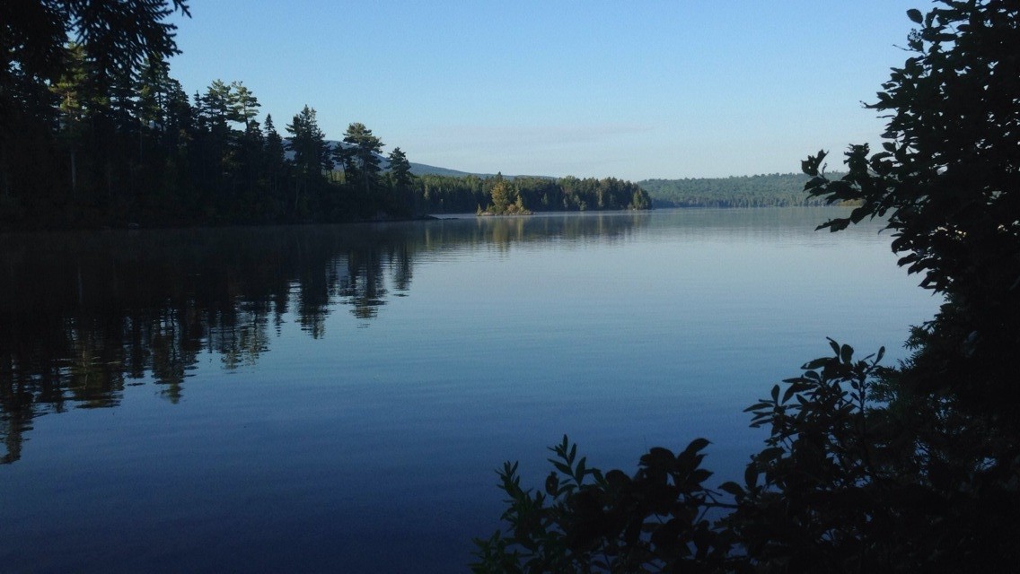
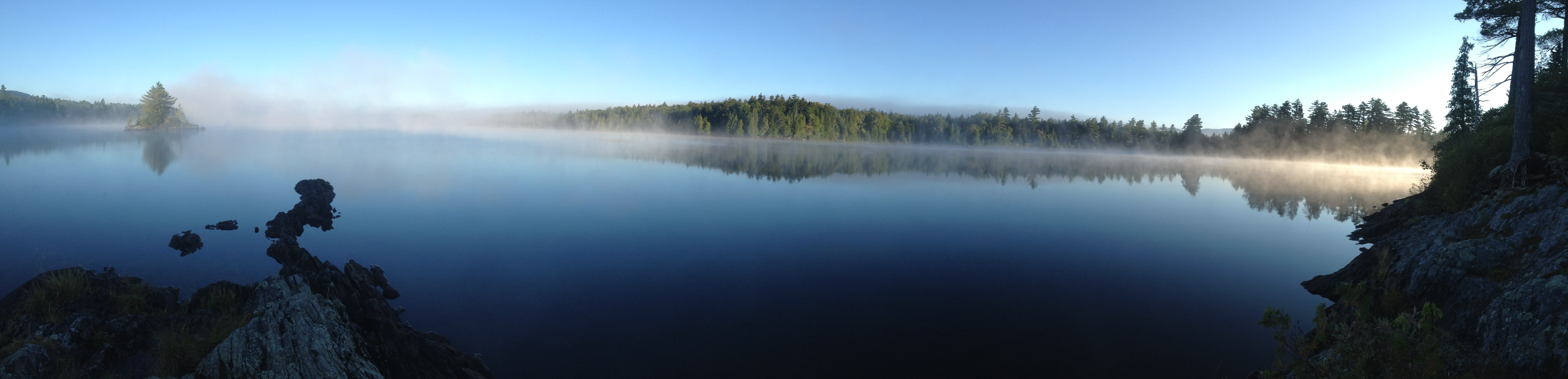
The moonless night sky in the northwoods east of Greenville was absolutely beautiful. Sorry, no nighttime photos, but I’ll include a morning photo. And nighttime photos wouldn’t do it justice anyways. The sky (as viewed from boats on the still lake) had so many stars that it felt four-dimensional – I felt the immensity of it as we looked deeper into space to more distant and fainter stars. Some students saw the Milky Way for the first time in their lives. Defintely a highlight.
Prof. Emily Lesher led us through an investigation of the chemistry and landscape associated with acid mine drainage. Strictly speaking, this material was part of the Field Methods course, but by now the students are used to switching back and forth between different course content. Personally, I really enjoyed seeing students engage with new material and another professor. Many of them will be in Prof. Lesher’s Environmental Chemistry class in the spring, when this real-world example will surely come up.
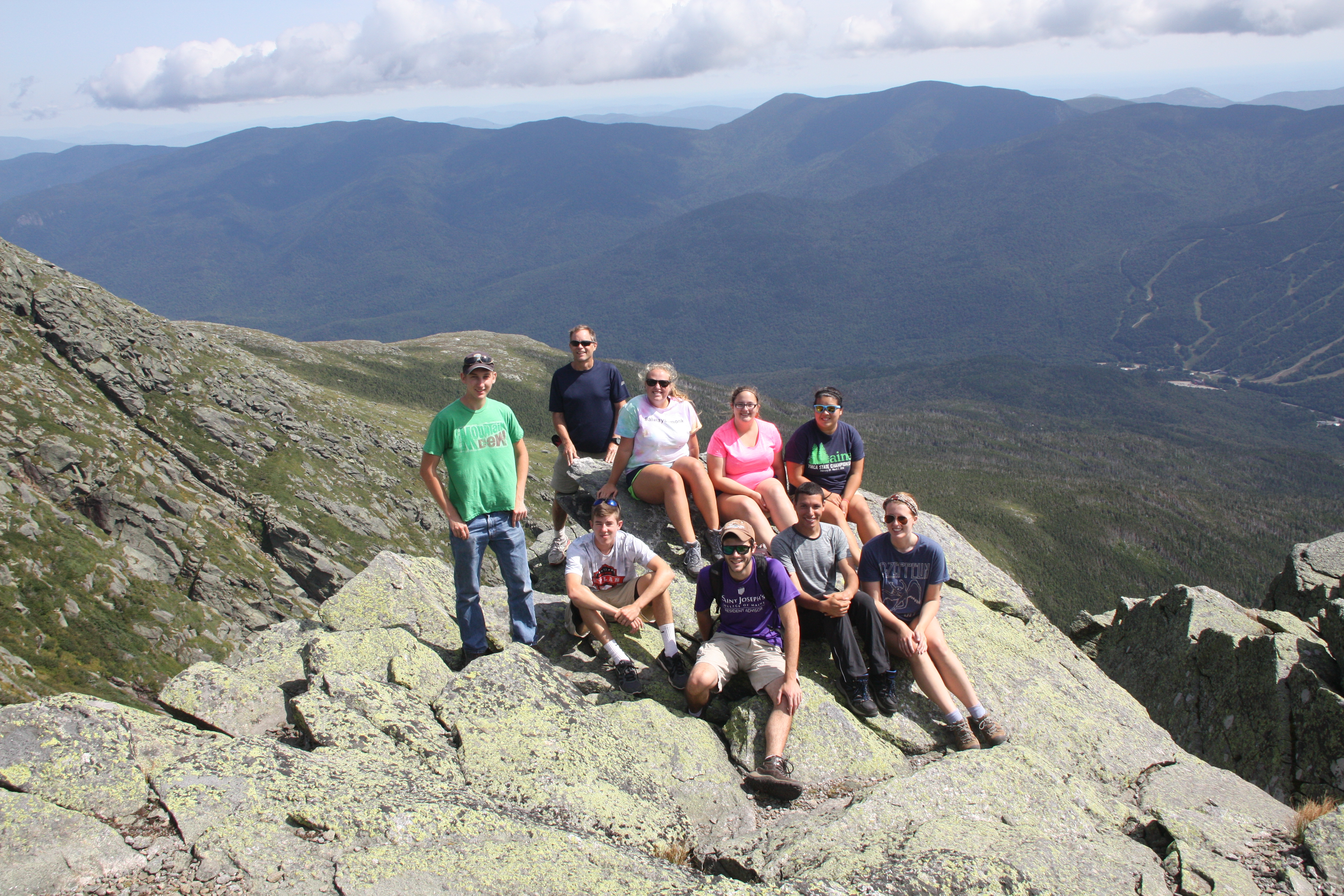
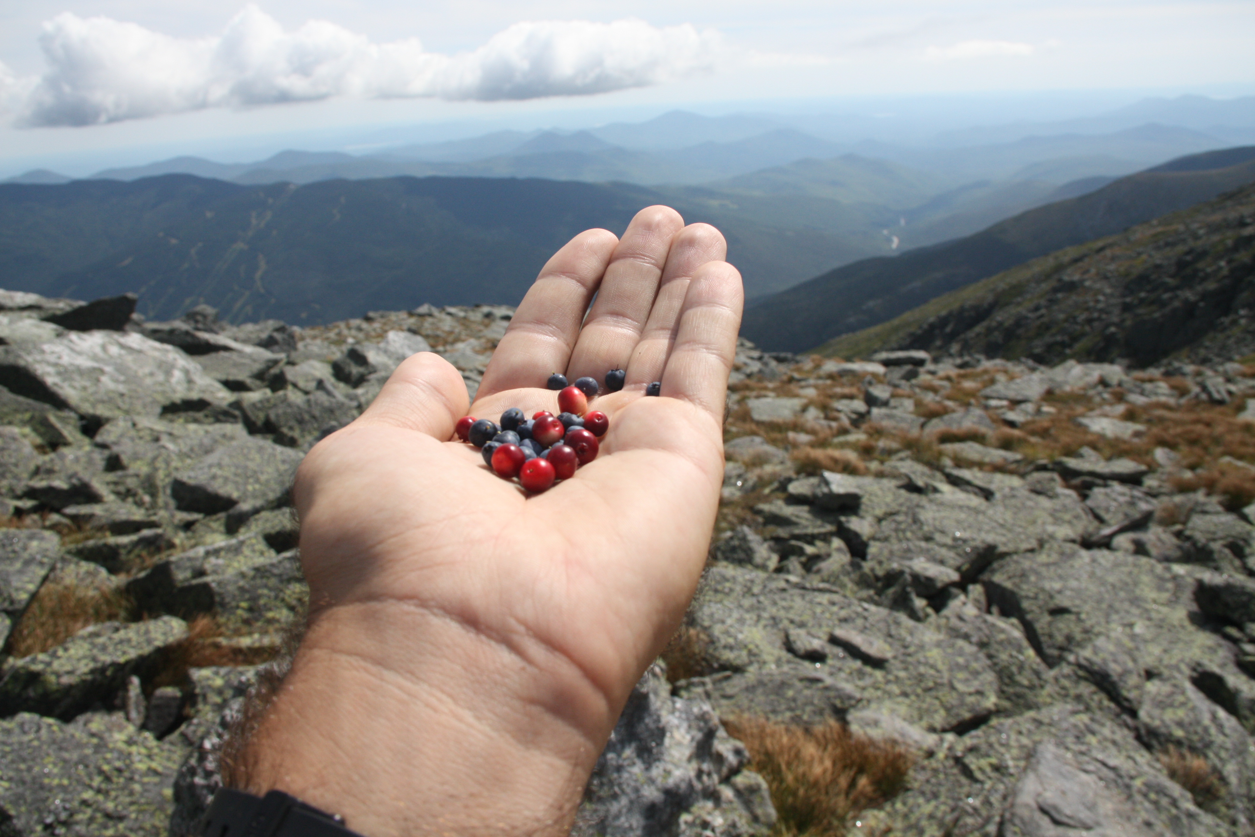
We drove up Mount Washington yesterday in order to get a view of several cirques created by alpine glaciers, most notably Tuckerman’s Ravine, Huntington’s Ravine, and the Great Gulf. A short walk to the lip of Huntington’s headwall led to more than one reassessment of what “steep” looks like. While there in the Alpine Garden, we enjoyed a late summer snack of wild blueberries and mountain cranberries. Some of us, including Jess Selva ’17 and Tyler Allen ’18, hiked over 4000 vertical feet from Mount Washington’s summit down over the headwall of Tuckerman’s Ravine and out to Pinkham Notch; legs were a bit stiff today!
We’ve endured just over 2000 miles of driving so far. It’s a really long way from Portland to Halifax. Fortunately, the longest distance to be covered in the remaining 6 weeks will be done on a schooner!
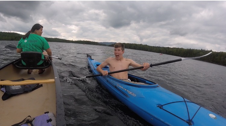
For the past 3 days, we have been at the Appalachian Mountain Club’s Gorman Chairback Lodge in Greenville, ME. After a long drive from Halifax finishing with dirt roads, we finally arrived at this cute little lodge. After moving our things into our bunkhouse, we were allowed some down time until dinner. Gorman Chairback is right on Long Pond and it’s about a mile and a half from one end to the other. In no time at all we were out on kayaks, canoes, and paddleboards. It was a beautiful, calm day and the water was just the right temperature as we explored the full length of the lake.
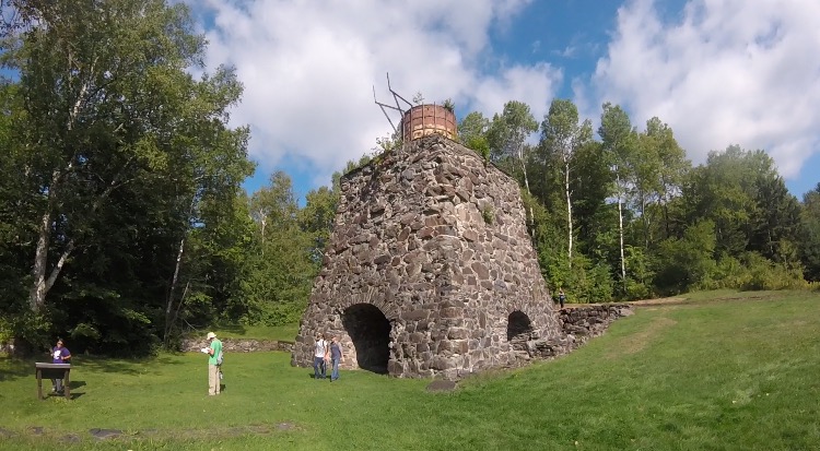
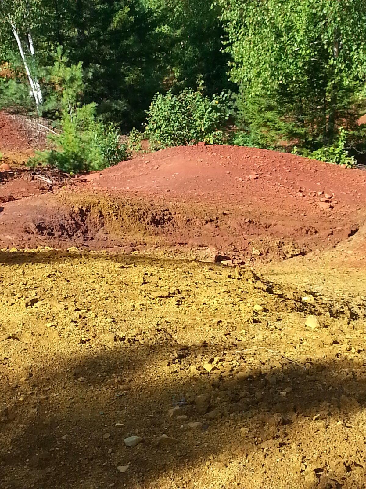
Dr. Emily Lesher and her family joined us for a few days to teach us about the nearby Katahdin Iron Works and the iron oxide deposits that fed it. First we visited the original smelting furnace and the one remaining charcoal kiln that have been there since the 1890’s. Prof. Lesher told us about how pig iron was made from limestone, charcoal, and ore. As the workers removed the surface layer of iron oxide ore from the nearby surface deposits, fresh iron sulfide was exposed. From more than a century of exposure to rain and air, the acidic runoff is getting into nearby streams and rivers at lower elevations and iron oxide is coating the soil. We took soil samples from different kill zones, tested pH levels, and tested acidity levels to see how the acidic drainage was affecting the waterways. Since this past season has been so dry though, the water levels have decreased and the amount of runoff into the waterways has also decreased, leaving the pH levels high (nearly neutral) and the acidity levels low.
That night we went back out onto the lake just as it was getting dark so we would be able to star gaze on a clear night. Most of us were in kayaks and we ended up staying out for almost two hours. We could see the Big Dipper, the North Star, Mars, the Milky Way Galaxy, satellites, and shooting stars. Never have we seen such a clear sky at night – the Milky Way was bright all the way down to the horizon. Yay for no light pollution! Soon it began to get cold and even darker so thankfully we all had our headlamps to get back to shore.
12 nights of mystery and 13 days on a schooner and we are finally on our way back, or at least in that general direction. The night before we knew it was going to be a long day with the goal to be as close to Peaks Island as possible by nightfall. But with the wind against us, we did not know it would be so difficult. At 7 a.m. the usual wake-up alarm goes off (Dr. Erikson), then it was time to pack bags and get ready to be on our way. A nice breakfast of cinnamon buns was made by Bobby on the Coleman stoves then came an unexpected visit by the captain, Alden, saying that he was concerned about timing and urged us to get on our way very soon. After packing our gear on the boat and getting ready to leave our island in Muscongus Bay, we headed out on a long journey on a sunny day. But what lay ahead was a bit more than we had anticipated.
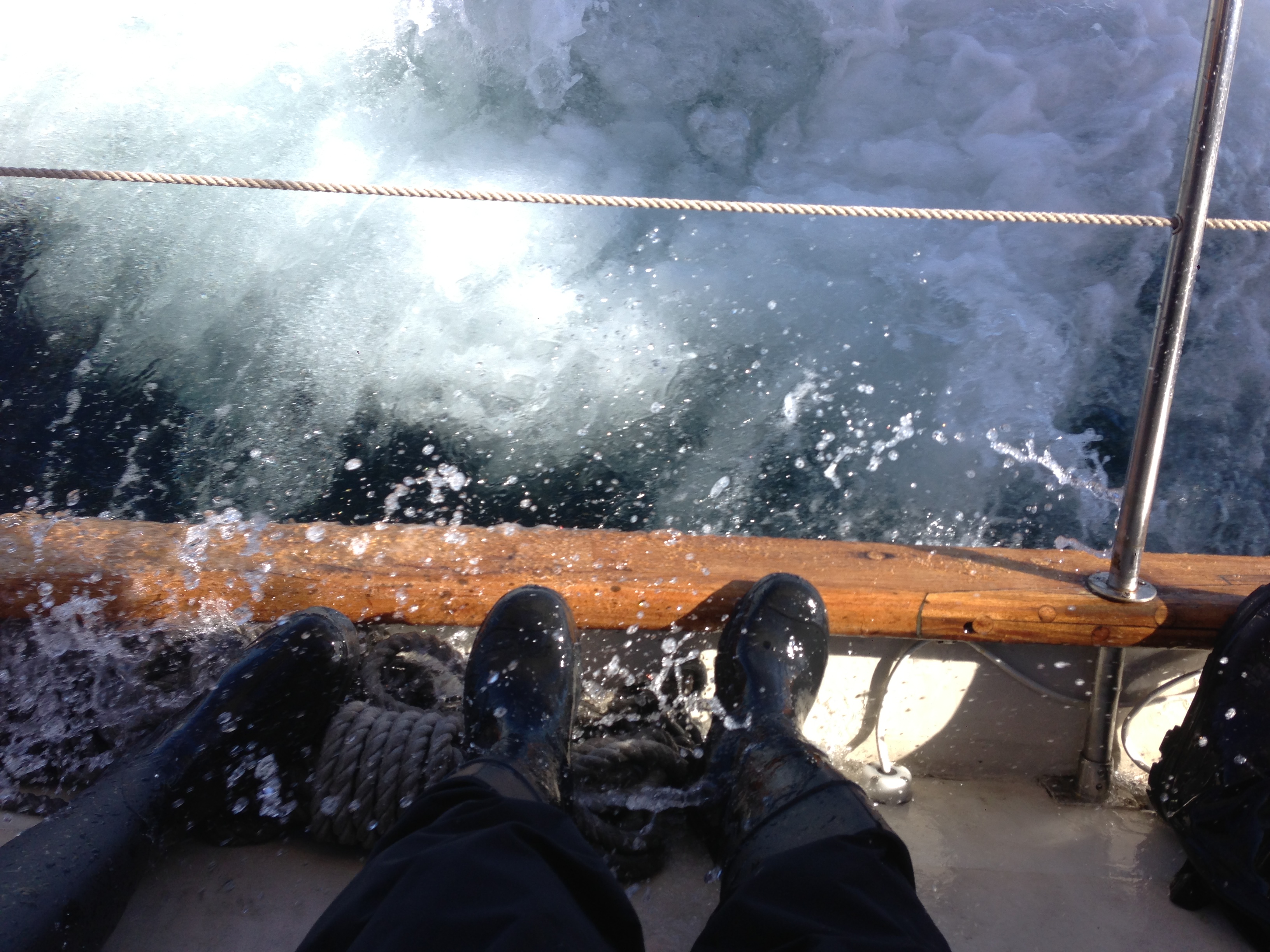
Passing by Monhegan Island, which we had visited the day before, we realized how rough the seas were. Also we learned very quickly that Dramamine, a sea sickness medication, is not very effective when taken once you are feeling sick. The boat was tilted (heeled, in nautical language) at what felt like nearly 90o but was only about 25-30o. That doesn’t mean that the waves weren’t crashing over the side of the boat any less. Often times the seas soaked those of us bracing ourselves with our feet on the edge of boat (gunwale). There was a nice moment as a school of Atlantic white-sided dolphins swam alongside and under us amongst the crashing waves.
Unfortunately we weren’t making very good time toward out destination, despite traveling at a respectable 6 knots, because the wind was coming from the southwest, which is exactly where we wanted to go. According to the GPS we were not going to be able to get to a spot to camp in Casco Bay until 9 p.m. or later.
With the weather only seeming to be less favorable as the day went on Dr. Erikson and Captain Alden made the call to head towards Boothbay Harbor. Despite the change in direction, the 4-6 foot swells weren’t any nicer; a few waves came crashing over the port side of the boat soaking many of us who had managed to stay dry up to that point. Even our dinghy sometimes disappeared because of the height of the waves. Around 7 p.m. we were finally able to dock in Boothbay where our fearless leaders took a minute to discuss plans as we waited on board. The decision was to unpack necessary gear for the next couple of days into Suzie (which we had left in Boothbay a few days ago). After a quick dinner Suzie took us back to Portland where we took the ferry to Dr. Erikson’s house for the night. Now we’re in the home stretch and it’s time to work on 2 large lab reports, a presentation and study for the final during the remaining 5 days of the ESS.
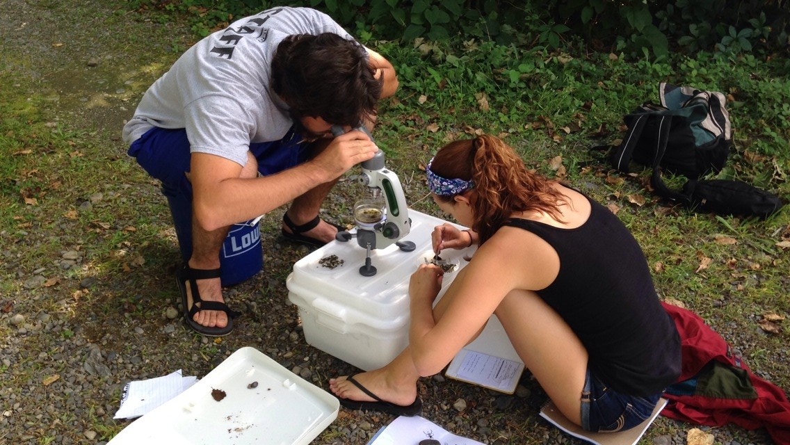
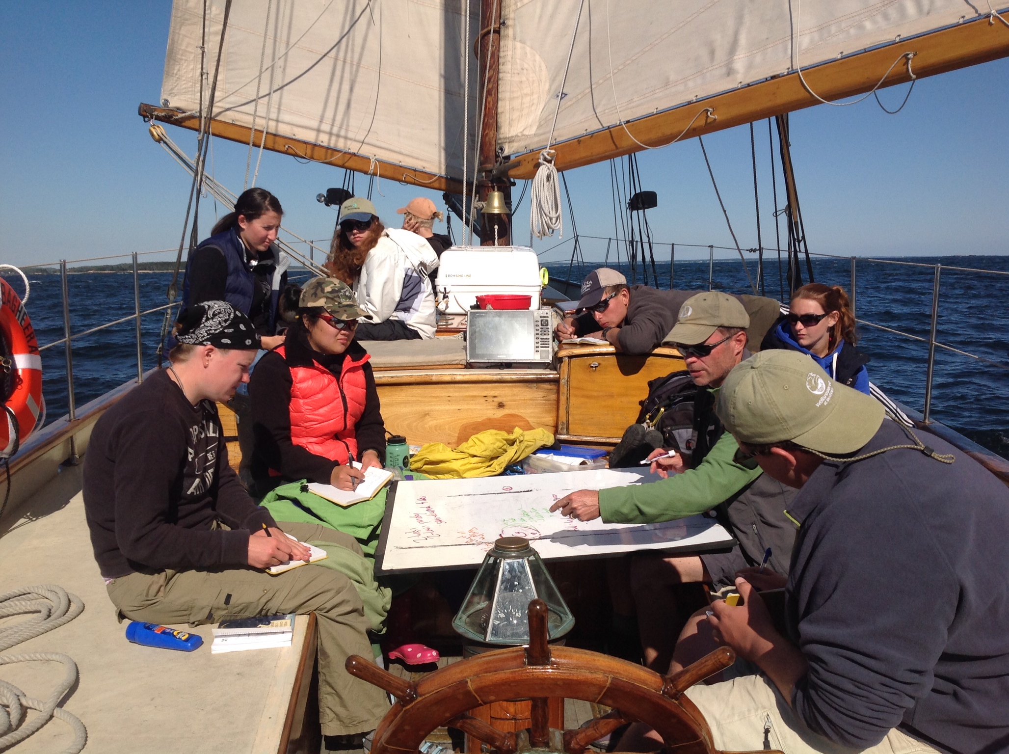
Sailing around the Gulf of Maine was not just for the joy of sailing, it was for sampling. Samples can provide insight on what is occurring in a water column. Our studies on the Bagheera were focused on how various chemicals and oceanographic factors could alter the water’s properties.
By using a YSI sonde (that is, a device with several probes on it that we lower into the water), we were able to compile how temperature, salinity, pH, chlorophyll, and dissolved oxygen differ with depth. The turbidity of the water was also recorded by using a Secchi disk. By the time we were done, we had ten sample sites from Casco Bay to Muscongus Bay.
What is causing this chemical characteristic to change with depth? What types of patterns are we seeing between sites? What outside factors, like seasonality and amount of land protection, could cause this level of chemicals/characteristics? These were just some of the questions that arose while recording data.
These types of questions and data can contribute to research questions on topics from climate change to the amount of detritus getting into Maine’s water systems. Tracing changes and comparing them to other sites can help map out Earth’s past and future.
There are advantages and disadvantages to using a sailboat as a research vessel and floating classroom. If there’s any wind, then sailboats tend to be more stable than motorboats with less rolling and yawing, and that makes for less nausea. Sailboats provide a lot more to do when moving between sampling sites, what with all of the tacking, jibing, and sail adjustments. From the academic perspective, sailboats certainly increase awareness of wind direction and intensity, which everyone quickly connects to wave conditions.
On the downside, sailboats usually take much longer to get from point A to point B, especially when point B is to windward of point A. And with uncanny frequency, even if you decided to go from B to A, rather than A to B, the wind would shift to make sure you have to sail upwind! In addition, sailboats heel when sailing toward the wind, commonly from 10 to 25 degrees, and that’s a challenge for most people new to the sea.
Our particular boat is the 52′ schooner Bagheera, built in 1924 here in Maine and operated by Portland Schooner Company. That’s the clincher. It’s hard to get more exciting than an gaff-rigged, locally built, 90-year-old schooner that’s sailed to Europe and back, raced (and won) in the Great Lakes, and spent years working on the West Coast.
Good weather and downwind sailing make everyone happy; even academic work seems to come naturally.
Big swells with wind is exciting and hard on productivity, but there’s lots to observe in terms of wave dynamics (plus nice scenery). However, big swells without wind is the worst combination because we don’t make good progress and queaziness sets in (except for the skipper, of course!). We hope for blue skies and fair seas!
When you first hear that you, the student, will be teaching the President of Saint Joseph’s College about salt marshes a lot goes through your mind:
1.Holy crap, it’s the President.
2.Holy crap, it’s the President.
3.Do we really have to?
4.Why the heck does he want to learn about salt marshes anyway?
5.What if I mess up?
6.What if he knows more than me?
7.Why would Dr. Teegarden do this to us?
8.Will he like me?
I mean, it was really quite a nail biter. It’s just so nerve racking – Nobody wants to let down the President of the College or their professor. However, when you get down to thinking, salt marshes are not really that scary, and neither is President Dlugos. He is actually a really down to earth, fun loving guy who is very interested in the Environmental Science Semester. What could really go wrong? Well, for starters, falling in would ruin the day quite quickly… It’s a good thing that did not happen.
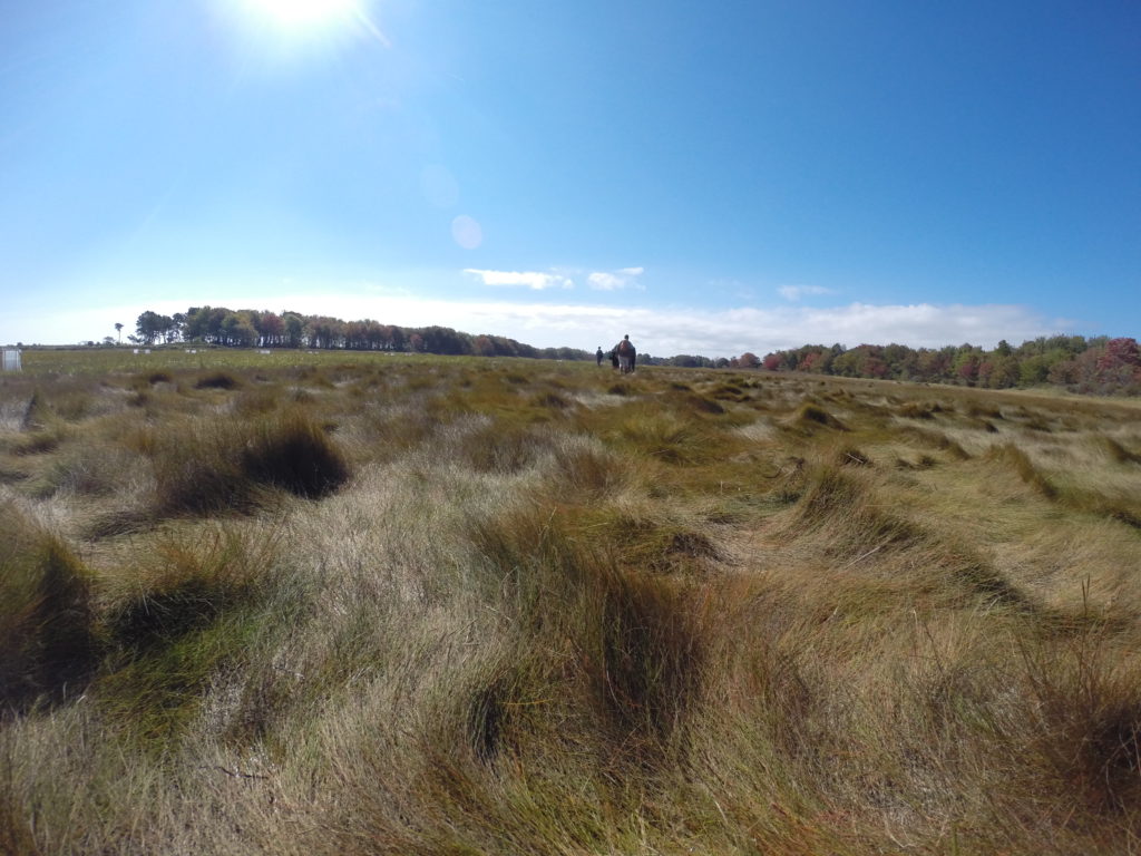
With tensions high and students eager to impress, the day started off with an introduction of the group to President Dlugos at the Wells Reserve at Laudholm. From there, we headed over to a dock to meet our captain for the tour of the Laudholm salt marsh and estuary. They showed us Wells Beach and the adjacent salt marsh, and they explained the complications that they are facing now and will be in the future. When the insightful boat tour had come to an end, we reconvened at the Research Center for a lunch of cold cut sandwiches and salad. By the end of lunch nerves were setting in once again. It was almost time for us to lead the President into the salt marsh and show what we know. On the walk there the names of species, zonation patterns, and processes were running through our heads. A few minutes later the time had come. We were out on the salt marsh with an eager President and professor waiting to hear us teach. Dr. Teegarden prompted us into a discussion which we quickly picked up. Without skipping a beat the group of eight chimed in with answers and ideas. It was like no one was watching and we were having a class discussion. There were laughs and information shared. Before we knew it, the class was over – We did it! With a sigh of relief half of us went to count green crabs while the other half split off to write a lab report. Just another wicked cool day on the ESS.
Ingrained in our memory by Dr. Teegarden is the answer to some important questions about intertidal zones along ocean beaches.
First Question: Where does Marine Ecology start? Answer: Observing patterns of abundance and distribution.
Second Question: How do you figure out the cause for the pattern of abundance and distribution? Answer: By identifying processes, then forming a hypothesis about how the physical and biological forces caused the pattern to occur.
Third Question: What is the main pattern found in the intertidal zone? Answer: The main pattern found in the intertidal zone is zoned layering of different organisms.
Fourth Question: What causes the zonation in the intertidal zone? Answer: Some of the major factors include: competition, ability to survive despite certain stresses, and predation.
This may sound like absolute craziness to someone who had not spent 3 weeks learning about Marine Ecology during the ESS. Though next time you go to a rocky beach or salt marsh at low tide I would like to challenge you to look for something we have now learned to see. There will be layers of different types of organisms (plants for salt marshes,seaweed and barnacles at the rocky coast). Some will be closer to the water, some will live farther away from the water, and scientists have spent countless hours figuring out the reasons.
In the rocky intertidal zone organisms prefer to spend more time in the water and avoid desiccation. The organisms closer to the water at low tide spend more time under the water and are better competitors meaning they are able to beat out other organisms that would want to live there. Why don’t those organisms control the entire zone? This is because they are not able to survive the exposure (a stress) out of water that the organisms above them can. So in summary, what causes this “zonation?” First: competition for more time spent in the water. Second: ability to deal with exposure out of the water.
With salt marshes this pattern of competition and stress is in the opposite order. Organisms that live further away from the water are the stronger competitors. The salt is in this case the stress and is harmful to the plants, some of which have adapted ways such as pulling the salt from their roots up through their stem and out the leaves.
But this is for only 2 places out of the many of places we have visited and because of that there are countless structures. For our friends and family out there you may understand why we can never look at these areas the same way again. For that new-found understanding we thank the boundless knowledge banks both Dr. Teegarden and Dr. Erikson have shared with us.
Some of the most amazing adventures we have had so far happened at Gorman Chairback! Gorman Chairback is an Appalachian Mountain Club (AMC) hut in a township of Northern Maine, near Katahdin Iron Works. We learned about the effects of iron-mining pollution on local organisms with our guest professor, Dr. Emily Lesher. We sampled 3 different areas and used special nets to collect microinvertebrates (bugs), before recording how many we found. We also took pH levels of those areas and found out that the area with the most iron pollution had the least amount of organisms living there and the lowest pH values (i.e., more acidic) than the other places. It was interesting to see that there was more algae in the polluted stream than in the better water, probably because the microinvertebrates that graze on the algae couldn’t survive in the polluted stream. I (Nhu) fell into the stream while wearing waders, which ended up filling with water. So that was an experience!
At Gorman Chairback, we also went canoeing on their incredible lake, as well as paddle-boarding, kayaking, and swimming. The food there was beyond our expectations. It was so delicious and great. They used fresh produce from their gardens that they picked half an hour before dinnertime. They made their own bread for everyone’s lunches every single day. Some of the things we got to eat were: beef brisket, chocolate cake with peanut butter frosting, grilled vegetables, raspberry pie, almond pastries, and so much more! They had a sauna, really great (and warm!) showers, and composting toilets. What was really cool was that they only use solar, propane, and wood as their only sources of energy, since they are 100% off the grid.
Erin and the two of us stayed in our own cabin right on the lake. It was the best night of sleep yet! There was a woodstove, two beds, paintings on the walls made by past guests, branches for hooks on the walls, a wash basin with a matching pitcher, windows, and a great view of the lake when you woke up. Both mornings, we awoke to the sound of loons and at night time, we watched the moon reflected off of the lake like a mirror. It was so serene.
On the last day, hours before we left for the White Mountains, the majority of us went out by either a kayak or a canoe to a far off island on the other side of the lake. Some of us explored the island briefly, and found that it actually had a house on it. As we were coming back, Dr. Erikson suggested a balancing game in the middle of the lake. The object was to stand up in your kayak or canoe, without falling into the water. Dr. Erikson went first, and flipped his. With the help of Bobby, Erin, and Ayla, he was able to empty out the water that had started filling his kayak and get back in. Next, Bobby attempted doing the same, and was successful in almost standing in the kayak, without flipping it. Ayla tried it next, and did the best, as she completely stood straight up in her kayak and sat back down, all without getting any water on her. We all shared some laughs and headed back to pack the van.
We stopped for ice cream at Gifford’s Ice Cream in Farmington, Maine. It was so good, because it was a hot day, and we had been all cramped in the van for a while. We were ready to go off to our next destination classroom, the White Mountains of New Hampshire!


 With salt marshes this pattern of competition and stress is in the opposite order. Organisms that live further away from the water are the stronger competitors. The salt is in this case the stress and is harmful to the plants, some of which have adapted ways such as pulling the salt from their roots up through their stem and out the leaves.